
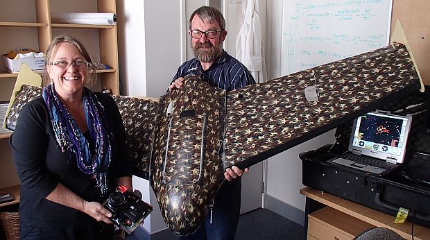
In their mission command room at AUT John Robertson holds the SawmpFox unmanned aerial vehicle or UAV, and Barbara Breen holds two cameras that are mounted under the UAV for taking aerial photos (image: A. Ballance)
A frustration with clouds obscuring details in satellite photos and a chance conversation has led to a fruitful collaboration at AUT, the Auckland University of Technology. With the help of colleague and model plane enthusiast John Robertson, and recently retired glider pilot and microbiologist John Brooks, spatial ecologist Barbara Breen has been developing the use of UAVs or Unmanned Aerial Vehicles as an ecological tool.
Alison Ballance joins Barbara and John Robertson in their mission command centre to find out more about the Kahu Hawk UAV – their first smaller glider – and their newer Swampfox. The Swampfox is New Zealand designed and built - the airframe was designed by Palmerston North-based Skycam UAV Ltd. in conjunction with the University of Queensland; the autopilot was designed by the New Zealand Defence Technology Agency, and the whole aircraft and systems were constructed Skycam UAV.
The UAV’s are a platform for taking aerial images, which are later stitched together using Pix4UAV software to create, for example, 3D images of forest patches, which can be real colour, near infrared or infrared.
The SwampFox was recently flown in Antarctica’s Dry Valleys in a collaboration with the University of Waikato to measure cyanobacteria mats from the air. Barbara and colleagues hope that it will also be used to detect grassgrub in pasture, wilding pines and, eventually, marine mammals.

